
Tsinjoarivo is a unique, high-altitude rainforest found at the escarpment dividing Madagascar’s central high plateau from its eastern lowlands. The main forest block is located southeast of Ambatolampy (19º42’S, 47º48’ E, 1400-1650 m elevation), and only about 80 km SSE of the country’s capital, Antananarivo. This region contains a unique, unprotected block of mid-altitude rainforest in the island’s central domain, on granite and migmatite bedrock. The forest is part of a previously-continuous corridor extending between Ranomafana National Park (approx. 150 km SSW) and Mantadia National Park (approx. 100 km NE).
Typical landscape at Tsinjoarivo
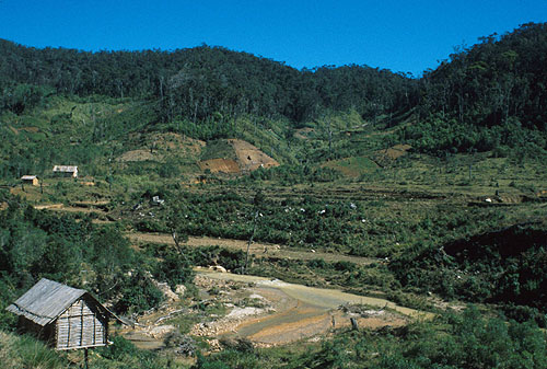
Tsinjoarivo is ideal for studies of fragmentation because of the existence of an east-west fragmentation gradient over a distance of less than 15 kilometres. The eastern margin of the forest corridor at Tsinjoarivo is coincident with the abrupt eastern escarpment, where the elevation rapidly drops from about 1400 m to 800 m, moving west to east. Human settlements exist just east of this drop-off, but because the escarpment acts as a natural barrier, the eastern part of the forest remains largely undisturbed.
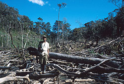 Recent deforestation ("tavy") |
The western margin of the forest corridor, in contrast, is topographically continuous with the high plateau to the west. The western half of the forest has therefore been drastically fragmented and degraded by an influx of settlers from the high plateau. Although the age of the fragments is not known directly, interviews with local people indicate that fragmentation began approximately 50 years ago. |
I have established three main research camps within the Tsinjoarivo region. Mahatsinjo camp is located at the centre of a network of forest fragments in the western half of the forest corridor. The land surrounding the fragments is a mixture of settlements, cultivated land (wet rice paddies, corn, beans, potatoes, sweet potatoes), grass, and secondary forest regrowth (“ala savoka”). Because lower areas have been preferentially cleared, fragments usually exist on top of hills and ridges. Vatateza camp is located within continuous forest in the eastern half of the forest corridor. Human settlements are located nearby, in the Onive river valley to the south. Finally, Ankadivory camp is located roughly between Mahatsinjo and Vatateza - in forest that has suffered intermediate disturbance. Climate is similar at the three sites – there is a rainy season between December and March and a dry season between April and November. Temperature is highest in December-January and lowest in June-August.
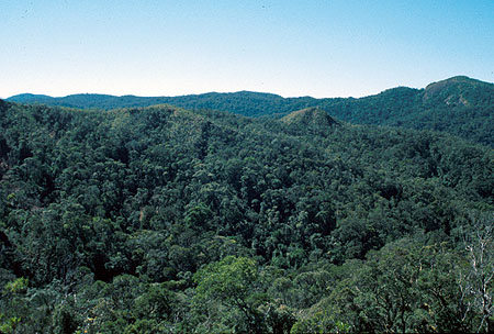
Unbroken forest at Vatateza
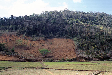
Forest fragment at Mahatsinjo
Like most rural areas in Madagascar, economic and educational opportunities are few and far between, and public and environmental health is suffering. Most children go to school, but it is usually only for a few years, as the community-run schools are expensive (many areas do not yet have government-sponsored schools) and parents often need the extra labour in the fields. |
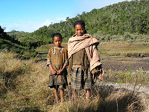 Neighbours visiting the research camp |
Hunting of lemurs and other animals was fairly common when our research teams arrived, but these activities have decreased. Most households grow as much food as they can and buy and sell to obtain the rest, but many households have taken to producing rum in order to supplement their income. Recognizing that conservation efforts often fail when they don't improve local socioeconomic conditions, we have attempted to combine our research and conservation activities with education and local development initiatives.