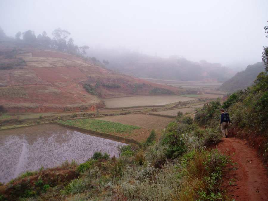
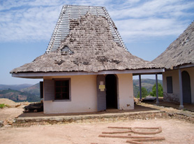
Tsinjoarivo is the name of a rural town located 47 km southeast of Ambatolampy and 80 km SSE of Antananarivo, as well as the name of the surrounding "rural commune". Tsinjoarivo played a unique role in the 19th century (the last century of Malagasy history before French colonization). It is the site of a royal palace ("Rova") built in the 1830s, which was used as a vacation residence by three queens and various prime ministers. The site was chosen by Queen Ranavalona I in 1832, and a five-building complex was built in 1834-1836. The Rova was used as the monarch’s summer residence until 1896, and was visited by three monarchs: Ranavalona I (1840, 1842, 1856), Ranavalona II (1880, 1882), and Ranavalona III (1890). The Rova buildings and the museum they contain are currently being rehabilitated by the Region d’Auverge as part of their efforts to promote tourism at Tsinjoarivo. The Rova is surrounded on three sides by the powerful Onive river, which cascades over spectacular waterfalls including Andriamamovoka (“the mighty sand-maker”) and Ambavaloza (“the mouth of danger”). These waterfalls were the initial attraction of the site, and one of Ranavalona I’s favorite pastimes was to watch as a cow was thrown in the water and fell helpless over the massive waterfall. Although the region surrounding the town is largely deforested (due to a longer history of human settlement), the eastern third of the comune contains the most intact and continuous natural rainforest remaining in Madagascar’s high plateau ecoregion (continuous with lower-lying rainforest in the adjacent Anosibe an'Ala commune). |
 |
|---|---|
 |
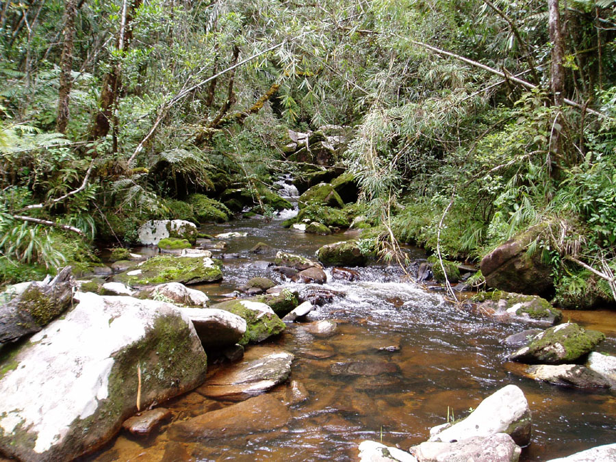
The forest’s western half is topographically continuous with the island’s central plateau, and lies between 1300 and 1675 m altitude. Historically, it has been fragmented and degraded by settlers from the central plateau. In contrast, the eastern half lies at slightly lower altitude (1200-1600 m), but because the eastern boundary of the forest corridor is coincident with the steep escarpment, it is perched almost 1 km above the coastal lowlands below. As a result, the eastern part of the forest is less accessible to humans and remains minimally disturbed.
Click here for a map of Tsinjoarivo.
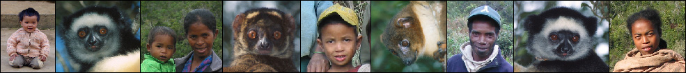
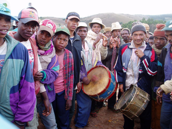
People of Tsinjoarivo
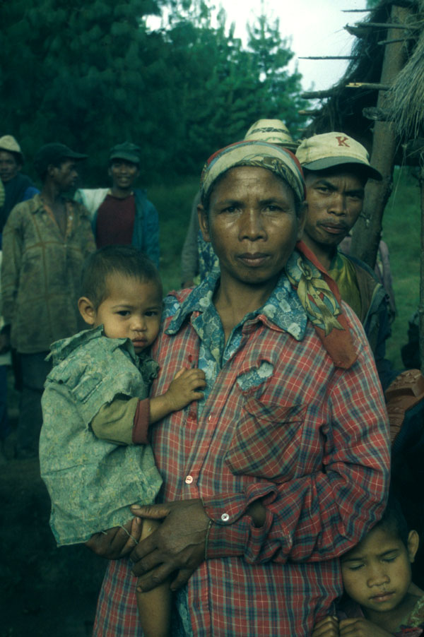
Tsinjoarivo forest is a north-south corridor of rainforest within the strip connecting Ranomafana (to the south) and Mantadia (to the north). Just as Tsinjoarivo spans the divide between the central high plateau and the eastern lowlands, it also spans the divide between two ethnic groups. The Betsimisaraka are represented by a small population in the eastern part of the forest, and the Merina are represented by a larger population in the western part. It was an influx of Merina settlers from the high plateau (to the west) coming through the town of Tsinjoarivo that caused the forest loss and fragmentation in the western part of the forest during the second half of the twentieth century. |
 |
 |
Before 1970, the entire region east of Tsinjoarivo town remained largely forested. Merina people from Tsinjoarivo and farther west used particular valleys within Tsinjoarivo commune (such as the Mahatsinjo region) to graze their cattle (within the forest). Since 1975, these same people (or their family members) cleared much of the forest at Mahatsinjo and other areas to make sugar cane fields - one of the main sources of income was producing the Malagasy traditional rum (“toaka gasy”) derived from sugar cane. Additionally, while they cleared the forest, they sold the forest wood to sarety (oxcart) makers (roughly 90%), and sold other woods for house construction (roughly 10%). The sugar cane fields proved to not have sustainable yields, therefore most of the sugar cane fields were converted to sweet potato (voamanga), cassava (mangahazo) or corn (katsaka) fields. During this time, the traditionally-recognized rights of access by cattle developed into full-time residency: more and more people came to live permanently within the area and built larger and more permanent houses with rice paddies. |
Currently, some local people are still trying to clear forest for making traditional agriculture area. This consists of both the expansion of existing fields and the clearing of new valleys (often by offspring or relatives of original settlers). In the intact forest that still remains, many people are illicitly extracting the largest forest trees to sell to the sarety makers. This often starts a progression towards forest clearing: first, the largest trees are extracted and sold, then, they use the smaller wood for local construction and fire wood, and finally they clear the remaining disturbed forest for cultivation.
In addition, there are several other common extractive practices. First, local people continue to make rum (“toaka gasy”), and use local forests as sources of the Rotra (Syzygium spp.) bark for laro (an additive in the fermentation process). Second, people also use also the leaf litter from within the forest as compost for their vegetable fields (epoka/zezika). Some traditional healers still use various forest products (leaves, bark, roots…) for medicine or drugs. The final daily use of the forest is the collection of dead wood for cooking fires, small trees or bamboo for temporary construction (e.g. livestock shelters), or for making tools (e.g. shovels, machetes, cattle whips).
The impact on the forest has been extensive. Already, most people can no longer find the best woods for house construction, such as Ocotea sp. (except in the more intact forest farther to the east). Instead, they just use the biggest trees available (of any species) as construction materials.
Wildlife of Tsinjoarivo
Walking through the forest, one stands a good chance of encountering the Sadabe (Propithecus diadema - the largest and most conspicuous of the lemurs). The sadabe lives at relatively high densities (up to four groups per square kilometer) and our research teams have habituated several groups so they are not afraid of people. This 5-kg animal lives in small family groups, usually including just mother, father and up to four children of various ages. Its diet includes more than a hundred plant species, from which it eats fruits, seeds, flowers, leaves and galls. Its most favoured foods are the large, juicy fruits of the tall rainforest trees, which are usually only available in the rainy season (January-March) and are often missing in the small forest fragments. Its most important food is the Malagasy mistletoe, a parasitic plant whose flowers and leaves provide an important fallback food during the lean, dry season (May-August). |
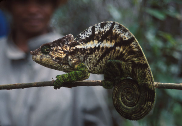 |
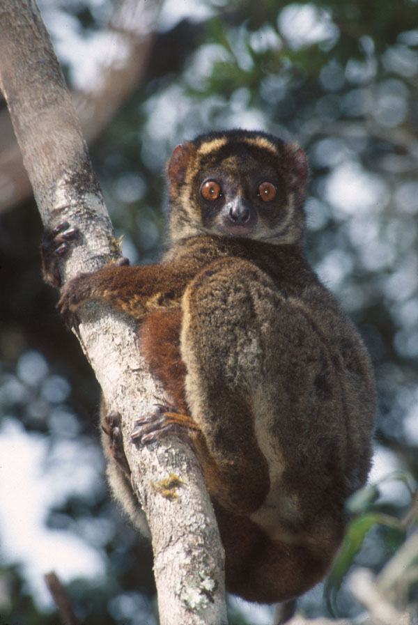
Other lemur species are difficult to see, being smaller, more cryptic and often nocturnal. However, it is fairly common to surprise a sleeping woolly lemur (Avahi laniger, pictured below) during its daytime slumber. Other highlights of this high-biodiversity forest include several chameleon species, leaf-tailed geckos, bright blue Malachite Kingfishers, and beautiful orchids and epiphytes.
 |
Biological surveys at Tsinjoarivo, though brief, have revealed a high level of biodiversity, with at least 9 primate species, 17 insectivores (including 16 endemic tenrecs), 7 rodents (including 5 endemic nesomyines), 5 carnivores (4 of which are endemic), 92 birds, 24 reptiles and 30 amphibians. In particular, this region is now recognized as having the highest species diversity of endemic insectivores (Tenrecidae) in Madagascar. Ongoing botanical surveys have so far indicated the presence of at least 247 plant species. The potential for high endemism at Tsinjoarivo is due to two biogeographic factors. First, two major river barriers separate Tsinjoarivo forest from adjoining rainforests: the Mangoro river to the east and the Onive river to the south. Second, Tsinjoarivo is a high-altitude "island" - though the forest is continuous to the south and northeast, altitude drops sharply in both directions. In fact, Tsinjoarivo is among the highest of any remaining Malagasy forests - and because it is topographically continuous with Madagascar's central plateau (now largely deforested), it has the potential to house remnant populations of species unique to the plateau. Sadly, like many places in the world, anthropogenic pressures are pushing Tsinjoarivo's unique species down a slippery slope to extinction before researchers can even finish cataloguing them! |
Want to visit?
Development of ecotourism at Tsinjoarivo is currently underway, through efforts and collaborations between Sadabe, the Auvergne Region of France, the local association "Maitsoanala", and local authorities and communities. Ecotourism will be centred around the village of Mahatsinjo, where tourists have easy access to nine lemur species, dozens of endemic birds, as well as chameleons, orchids, and in general a rare high-altitude rainforest landscape. The Queen's Palace at Tsinjoarivo is currently open for tourists and there is a tourist guesthouse next door: "Le Gite du Rova". Travellers wishing to experience "village tourism" in the Tsinjoarivo region should contact "Association Vonona". For more information about the ongoing development of infrastructure, or the availability of guides for forest excursions, contact SADABE directly. |
 |